
ELPAIS.com
- Acceder al gráfico
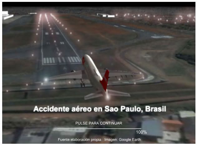
The reconstruction made here is very complete. They use Google Earth as a base to show us excatly how the accident happened. The don't jst use the aerial view, they integrate the Google Earth image on a 3d animation.
elmundo.es
- Acceder al gráfico
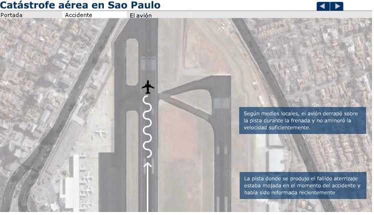
Here, the reconstruction is more technical, using a cenital view. The result is clean, and also offer a lateral view explaining how the plane went over teh avenue and finally crashed.
Público
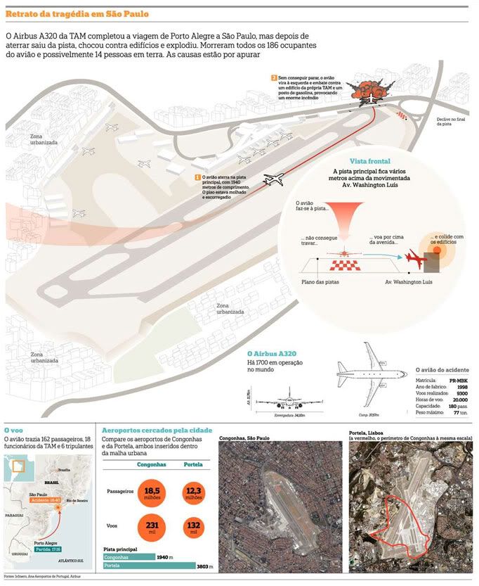
In the blog Innovations in newspapers you have an analysis about this graphic from Público (Lisbon), with good words about how they "localizaed" teh information, showing satellite images of Lisbon airport compared with Sao Paulo airport. teh reconstruction is clear and simple, but they use Google Earth (or other satellite imaging system, that's not the main thing) to give a WHY, so you can see Sao Pulo airport is to small.
Three different ways, with their good and bad things, but showing that Google Earth is an already assumed tool on teh graphics department, online or print
No comments:
Post a Comment